California braces for 'life-threatening' flood amid atmospheric river
It is considered the strongest atmospheric river event of the season and is set to begin Saturday night and early Sunday morning from north to south in California.
-

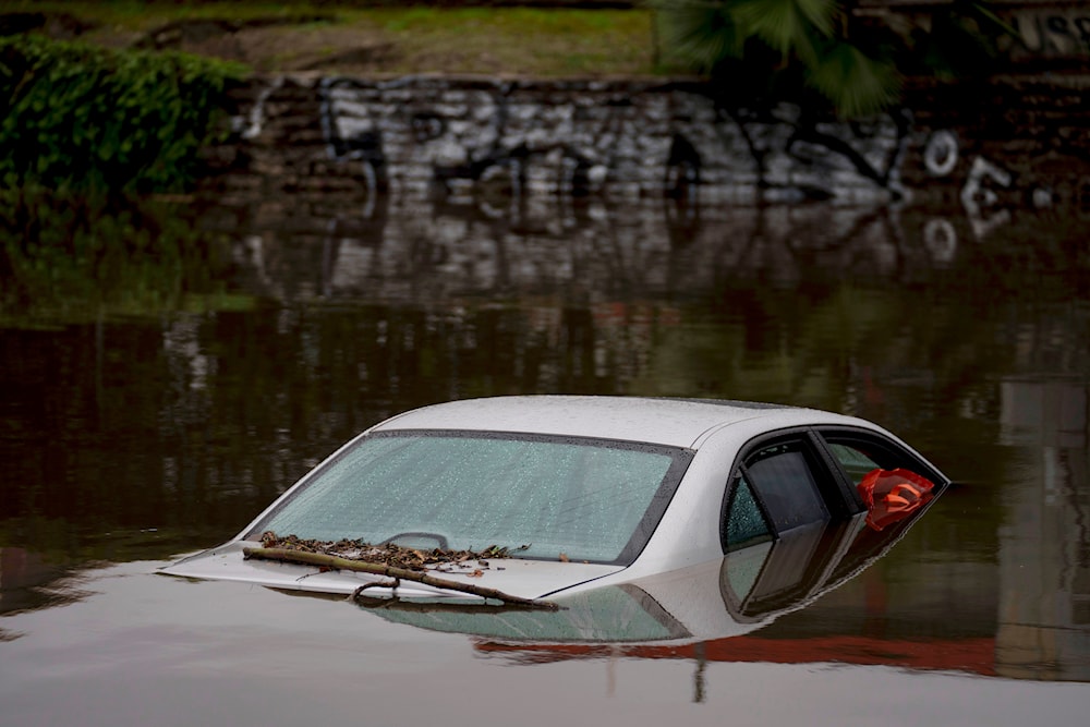
A car sits submerged on a flooded street under a railroad bridge, Thursday, Feb. 1, 2024, in Long Beach, California (AP)
The National Weather Service warned yesterday that a highly possible "life-threatening" flooding will happen in the densely populated LA County, caused by the strongest atmospheric river event of the season.
From Monettery southward to Los Angeles, the storm will carry a swath of 3-to-6-inch-plus rainfall totals in heavy amounts, with slightly lower amounts south into San Diego. Based on the current forecasts, Downtown LA is expected to endure around 6 inches of rain in three days with the potential of higher amounts, noting that LA's average annual rainfall is around 14 inches.
Sierra Nevada Mountains are also expecting several feet of snow possibly enough to block access to some communities.
Including those in LA County, 9.1 million people are under a "moderate risk" for excessive rainfall on Sunday, with 16.5 million under such a risk on Monday, which is rare to have this kind of risk outlook as it is the second highest on scale affecting a large US state, which will most likely flood.
Flooding and Mudslides in LA
The National Weather Service forecast offices in LA and the Bay Area are describing the storm's possible effects as "very dangerous", noting that the flash and river flooding will begin Sunday into Monday on already saturated ground due to recent rainfall.
In an online forecast on Saturday morning, the NWS LA stated, "Flooding issues will not be confined to just the foothills, mountains, and burn areas," stressing that "all areas, including highly populated urban areas, will be at risk for life-threatening flooding." They added, "Steams and small rivers, as well as the Los Angeles River through the San Fernando Valley and metro LA will rise quickly and turn into very dangerous raging rivers," concluding that "any roads will be impassable due to flooding."
They also warned of "numerous" mudslides in areas with steeper slopes, which might need evacuations as such effects have led to deaths in past atmospheric river events in the area.
A deeper look into the storm
The Transverse Ranges, which are the east-to-west oriented mountains in Southern California, are going to be hit by a heavy wave of tropical moisture from the southwest, which means that they could endure about 10 to 12 inches of rain in turn affecting Santa Barbara, Ventura, and Los Angeles counties, as well as others.
As a rapidly intensifying area of low pressure moves closer to the Central California coastline, higher winds compared to older atmospheric rivers from this winter are expected to be brought by the storm. The Bay Area is going to be one of the first victims of the latter with winds up to 70 mph and higher gusts in hills and mountains. It will also severely affect Southern California's power and air travel, causing power outages and delays in aerial navigation.
The storm will meet a strong atmospheric river, which is a narrow highway of moisture at mid-levels of the atmosphere, and let it settle at the California coast for a very long period. This means that the air containing a tremendous amount of water vapor will be intensified by peculiarly high sea surface temperatures.
UCLA climate scientist, Daniel Swain, explained, "The warmer the surface ocean is, the more potential evaporation there is off of it," adding that this is all a result of human-caused climate change and El Niño.
A 2022 study found that atmospheric rivers that hit California in 2017 were made up to 15% wetter due to human-caused climate change, suggesting such an influence may already be detectable, and the world is currently witnessing it as all recent nature events in the US and worldwide have shown higher intensity and are expected to grow in the coming years making atmospheric river events even wetter.
This storm will be a high-impact event for tens of millions in California, with a string of life-threatening hazards.

 4 Min Read


