Satellite imagery shows extensive damage in North Occupied Palestine
The Financial Times report referred to data from Netanyahu's office, indicating that Hezbollah's rockets caused more than 710 wildfires, burning 105 square kilometers of land across areas from Upper Galilee to the Golan Heights.
-

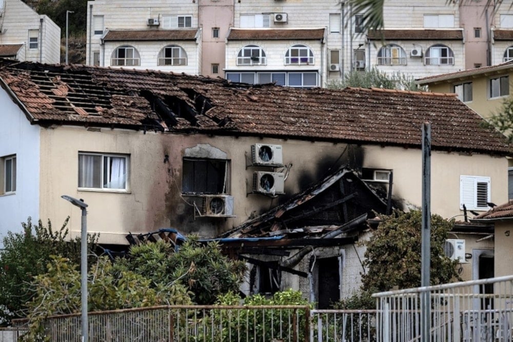
A damaged building in "Kiryat Shmona" as a result of a rocket attack by Hezbollah (AFP).
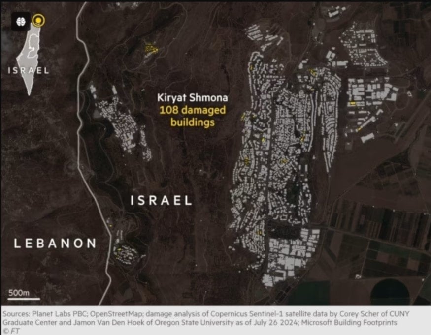
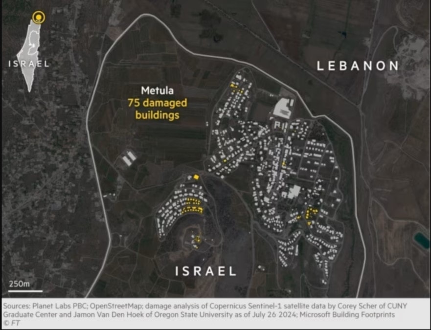
A report by the Financial Times on Saturday revealed extensive damage in northern areas of occupied Palestine, resulting from Hezbollah's operations. The report which includes satellite imagery details damage inflicted to buildings, crops, and economy activities in the region.
The war has triggered the largest evacuation of settlers in the North since the regime's founding over 70 years ago. Hezbollah's operations have caused widespread destruction, including burned crops, damage to infrastructures, and the closure of businesses, according to the report.
Damage to buildings, crops, and commercial activities
Satellite images published by the newspaper show that Kfar Giladi, a settlement located less than two kilometers from the Lebanese border in the Galilee Panhandle, has visible marks of cross-border fire between Israeli forces and Hezbollah.
In Kfar Yuval to the east, the wall of a house hit by a Hezbollah rocket has been blown open. Fields beneath the devastated town of Metula to the north have turned black from recurring rocket-induced fires. To the west, smoke rises from a forest fire on the hills above the kibbutz, sparked by the latest strike.
The report indicates that Hezbollah's fire has inflicted severe damage on buildings, burned crops, and closed businesses.
Even before the recent escalation, Hezbollah's strikes posed an unprecedented strategic challenge for "Israel." The "war of attrition" in the north has tested Israeli limits to the brink, increasing pressure on the regime to respond.
Widespread Impact
The report also cites data from Israeli forces, noting that between November and mid-July, Hezbollah deployed a small fraction of its vast arsenal, launching approximately 6,700 rockets and 340 drones into the north.
Despite this, the impact has been extensive and significant.
The report also referred to data from Netanyahu's office, which indicated that Hezbollah's rockets caused more than 710 wildfires, burning 105 square kilometers of land across areas from Upper Galilee to the Golan Heights.
The most significant disruption occurred in the five-kilometer-wide border strip south of Lebanon, evacuated by Israeli authorities in the early weeks of the fighting.
Settlements such as Kiryat Shmona, Shlomi, Metula, and Shtula, along with military outposts in the area, faced intense fire.
Ghost Town
Before Hezbollah's operations, Kiryat Shmona, near the Lebanese border, had around 24,000 residents.
It has now turned into a ghost town, with traffic lights permanently flashing orange, nearly all businesses closed, and checkpoints sealing roads to the border.
Municipal security officer Ariel Frisch reported that Hezbollah fired over 700 shells at the settlement since October 8, including previously unused weapons like armed drones, Falaq-1 rockets, and guided anti-tank missiles.
-

Northern Occupied Palestine severely damaged by Hezbollah missiles: FT
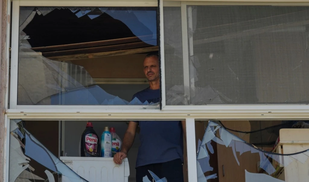
Sixty-six buildings sustained direct hits, while 1,100 others suffered collateral damage such as shrapnel-induced damage. Despite some border areas being inaccessible, damage estimates can be traced using satellite imagery.
Radar imagery also helps identify structures with extensive damage, altering their appearance from above. Radar analyses from the Lebanese border confirm that Hezbollah's fire caused substantial damage to buildings in towns throughout the northern occupied territories.

 3 Min Read


